Quetzaltenango: a story of three names and three exoduses
By Christian Díaz
First name
The story of Quetzaltenango is ancient. There is evidence of its first foundations dating back to the late Preclassic period, when the expansive valley in which the present-day City of Quetzaltenango is located was first inhabited by human beings. In fact, it is known that the flora was lush and the fauna were prodigious, but it wasn’t until around the year 200 B.C. that the Mam Maya culture was the first to be driven towards the profuse unexplored zone by their ancestral gods, who sent the wise among them to settle in a new sacred place with extensive resources.
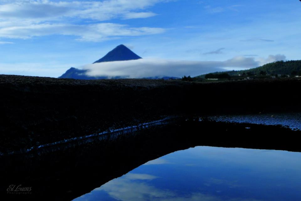
The first Mam people settled in communities established around the base of the volcanoes, in the far south of the valley (today the neighborhoods Transfiguración and San Bartolomé in Zona 1 and part of Zona 4) and considered the volcano Lajuj Noj (today known as Cerro Quemado, Quetzaltenango, or Crespo) as the protector or guardian of the communities. It should be pointed out that in this time the volcano was active, but now as I write this chronicle it is dormant.
The Mam noticed that large quantities of water fell from multiple mountains and volcanoes in the area, converging in the neighborhood we today know as La Ciénaga, in Zona 2, forming a lagoon of great proportions. Due to this phenomenon, they first named their land Culajá or Q’ulaja, which in the Mam language means “gorge.” The Mam remained and developed as a community. Their towns grew and it is estimated that many of them are buried underneath the contemporary City of Quetzaltenango, though it is not known with certainty which was their capital or main population center.
First exodus and second name
The K’iche’ capital, known as Utatlán or Q’umarkaj, looking to expand its territory, found the Mam established in the valley, and began a powerful and crushing invasion. The Mam, unaccustomed to war, were forced to give up and retreat from the area, abandoning their territory and leaving it in the hands of the K’iche’, who wasted no time in naming it Xe Lajuj Noj, which in the K’iche’ language translates to “under the ten thoughts” or “under the ten ideas,” the etymology of which varies and involves diverse anthropologic theories, the most supported of which is that the valley was surrounded by ten important peaks, for which it was named. It is also said that the K’iche’ had a system based on 10 domains.
Based on the above, it is evident that in Quetzaltenango the number 10 is important, as it is intrinsic to its K’iche’ etymology. In the Parque a Centroamérica, there are 10 Corinthian columns in the frontispiece of the Palacio de Piedra or City Hall of Quetzaltenango, as well as 10 columns within the park itself, 6 on the south side and 4 on the north, always totaling 10.
Second exodus and third name
The K’iche’ didn’t stay in the valley for long. In 1524 Castilian armies under the command of Captain Pedro de Alvarado entered through Xetulul and Zapotitlán (now Retalhuleu) fighting with local inhabitants. Then, in Llanos del Pinal, there was a second great battle in which it is said that the K’iche’ prince Tecún Umán lost his life for the sake of the defense of his homeland, and finally the third battle which was waged in Llanos de Urbina, now Salcajá, which was the end of the K’iche’ reign in that area.
The Spanish, accompanied by Aztecs, Toltecs and Tlaxcaltecas, among others, whom they had previously conquered in Mexico, were able to vanquish the K’iche’, dispossessing them of their lands and giving a third and final name to the area, Quetzaltenango de la Real Corona Española y del Espíritu Santo.
Quetzaltenango is derived from Mexica languages and means “the place where quetzals abound” or “under the wall of the quetzal.” This is because, upon entering Quahtemallan (Guatemala), the Aztecs didn’t know the names of the towns, and when they were asked about them by the Spanish, they came up with them based on what they saw most in a given area. The quetzal was abundant in Xelajuj, and tenango means “the land where there is a lot of…” In this manner, they went on naming places throughout Guatemala, including Huehuetenango, Jacaltenango, Jocotenango, Chichicastenango, Mazatenango, etc.
Third exodus: the end of the colonial period
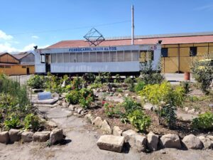
Together with Central America, Guatemala managed to achieve its independence from the Kingdom of Spain, forming the United Provinces of Central America, later known as the Federal Republic of Central America. It wasn’t until 1838 that the Quetzaltecans, together with departments in the east, formed the sixth state of that republic, giving it the name Los Altos, which was later invaded in an act prejudicial to federal and international law by the State of Guatemala. Said actions were commanded by Rafael Carrera, who overpowered the members of the government of the State of Los Altos, shooting them and joining the territory with Guatemala in an ignominious act, with the last invasion being suffered on the ill-fated day of April 2, 1840.
Indubitably, the history of Culajá, Xelajujnoj, or Quetzaltenango is deep, but even more so is the love that Quetzaltecans and visitors, regardless of their ethnic origin, have for the cradle of culture, the eternal Xelajú.